Researchers watch and learn as fire habits and human development reach a tipping point
Fire season was over, but the blaze still took hold. Residents of Glacier View, a rural Colorado neighborhood near the Wyoming boarder, were evacuated in early October after a prescribed burn set by The Nature Conservancy blew out of control.
Thanks to our changing climate, which is bringing about early snow melt and drier Summer conditions, the news abounds with apocalyptic scenes throughout the West—highways choked with cars making their escape away from a glowing night sky, people standing over a pile of their charred belongings, wondering how they will come back from such a loss. It’s an ironic fact that humans trigger most fires and we continue to increase the amount of damage those fires cause by building into forests that will eventually need to burn. Now some researchers are calling for a renewed relationship with fire, one that prioritizes preparedness over suppression.
Glacier View is a calm neighborhood sparsely dotted with yurts and rustic homes, where social clubs like the “Glacier Gals” provide residents a way to pass the time over potlucks and fundraisers. Neighborhood fishing derbies are organized at a nearby lake, and residents are over 20 years older than the Larimer county average of 40. While some were aware that a century of fire suppression had made the area dense with grasses and shrubs, providing extra fuel for a fire, no one expected a planned burn to be the trigger.
“It hasn’t burned in a hundred years, but this was weird,” said Richard Brown, who owns 35 acres in the area.
All summer, Judith and Richard Brown put in weekends of work renovating their yurt, which sits in a small stand of friendly firs on a gently undulating plot of otherwise open grassland and crumbling rock formations. Hauling loads of materials and tools back and forth from Boulder, where they live, was a labor of love for the soon-to-retire couple.
As a part of their conservation efforts, The Nature Conservancy has developed close ties with the U.S. Forest Service, hiring teams of firefighters to operate prescribed burns on private land around the country. Purposefully and with the due diligence of much red tape, these crews set fire to land desperate for a cleanse. But on that day in October, the forecast in Glacier View called for high winds. With the approvals for a burn already in place, Nature Conservancy crews went ahead as planned. Mr. Brown claims the organization is offering settlements to those who were affected, and a review of the event is still unfolding.
The Browns were spooked by the proximity of the action to their rural oasis, and by their neighbor’s accounts, including one who was unable to evacuate and needed protection from a wall of fire trucks throughout the ordeal. Over 70 people attended the community briefing seeking answers from local officials, a stat that the Browns emphasized multiple times in conversation, suggesting the significance of this small fire to the community.
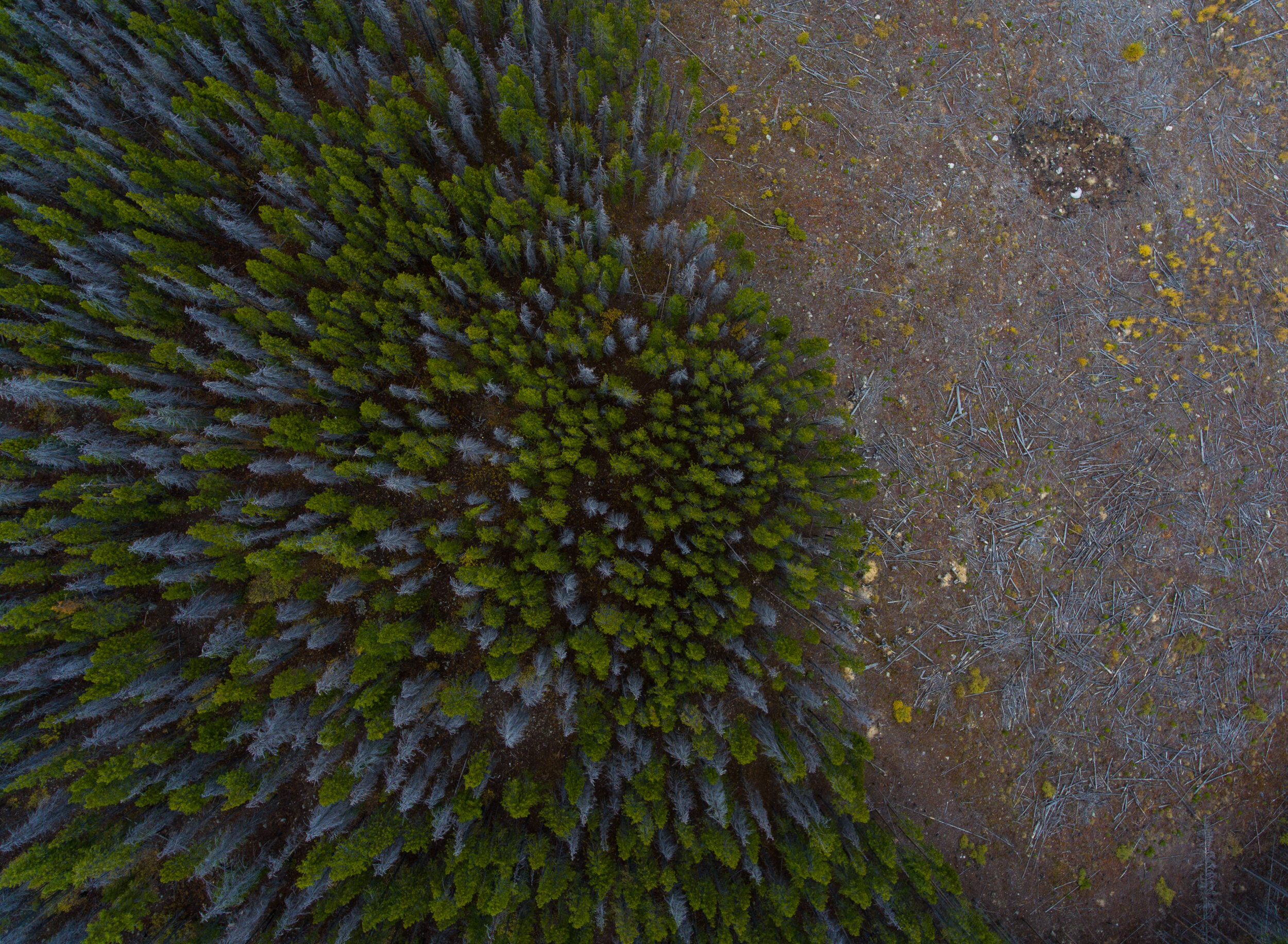
In fact, at 620 acres burned, this fire was so small it didn't even make a blip on the radar compared to those we’ve seen ravaging California, Alaska, and the rest of the Rockies. Searching historical satellite imagery, the scorched earth, otherwise known as a fire scar, is barely visible.
But the fact that residents were shocked by the potential for their land to burn is symbolic of an issue we have in the West: like those in the beautiful forested setting of Glacier View, we tend to put ourselves in harm’s way by building our homes deeper and deeper into the forest, without paying much attention to the fire hazard we’re getting ourselves into. According to Chris Wanner, forest ecologist at Boulder’s Open Space and Mountain Parks, there will be a 300% increase in development into Colorado wildlands by 2030, which will raise the costs of wildfire protection at the same pace.
“We need to rethink the way we relate with fire,” said Virginia Iglesias, a researcher at CU Boulder’s Earth Lab, a data analytics group trying to make better use of public data to answer pressing earth science questions and improve prediction of natural events. “Take earthquakes for instance. You don’t try to fight earthquakes. You either don’t move there, or you build your house accordingly.”
Iglesias is a petite Argentinian academic who speaks with a slight accent and a gleaming smile. She studies the intersection of society and extreme events such as fires or hurricanes. The term “extreme” is hard to define, but she proposes that it’s not about how big an event is on the Richter scale. It’s about how much damage it causes to human populations, which is an outcome of dense pockets of growth and development in areas of natural hazard-like forests and coastlines.
As a paleoecologist (like an archeologist looking for clues to our ecological past), she has been around the world from Patagonia to the Pyrenees digging into the earth studying layers of ecological history. After years of field work, she became interested in the effect of fire over time, “and by ‘over time’ I mean 20,000 years,” she explained.
What Iglesias learned is that there are three distinct periods in the human-fire relationship. Before man realized the ability to control fire, it was only triggered by natural events, specifically lightning. Around 7,000 years ago, human intervention took hold, and we triggered more fires than the world had ever seen to manage forests for hunting and scare off potential threats. Today, humans are still responsible for the vast majority of wildfire ignitions (usually accidentally, and most spectacularly on the Fourth of July) but because of changing climate conditions and development into wildlands, fires are becoming catastrophic and insurmountable. We even had to establish a new category for them: megafires.
“Maybe fires are bigger than what we can fight today,” said Iglesias. “Fifty percent of the Forest Service budget goes to fire fighting. Did we lose already? I don’t know.”
While Iglesias is a team of one, the rule at Earth Lab is that researchers must spend 20 percent of their time collaborating with each other. This led them to establish a day each week where all the teams get together to discuss ideas for cross-pollination. One such day inspired a collaboration in partnership with Zillow, the real estate database company. I got a sneak peak of the project when I met Iglesias at the spacious top floor lab housed in CU’s Sustainability, Energy and Environment Complex.
We sat in a lounge area outside their offices where the Colorado sun was piercing through the angled windows towering over us like a glass teepee; getting baked was a sacrifice you had to make in order to enjoy the beautiful Flatiron view in the distance. Iglesias removed a wool layer, then opened her laptop to the soon-to-be-published project. The culmination of their research is a simple map that plots fire risk in combination with human development across the United States, creating a single visual that shows how catastrophic a fire could be to any given area, and how likely it is to play out. The map proves the point made by Wanner, showing purple dots covering big swaths of the country where fire risk and dense human development overlap.
With data from Zillow, which was anonymized by totaling the number of buildings over an entire block to determine human density, you can look at the map and see that not only the obvious areas like the Northwest is at major risk, but also areas in the East. There, fire is rare--but if one were to sweep through, the damage would be tremendous. It would be particularly devastating to farmers, because fire tends to follow drought, which for a farmer would mean compounding events, one after another. Such a scenario is hard to imagine in what we tend to envision as a humid region of the county, but as the climate changes these are the new areas of potential hazard we have to face.
Using satellite data that goes back to the 1970s, fire researchers like those at Earth Lab are programming software to look at changes in land over time to figure out not only risk potential, but to understand how fire habits are changing across the country, and how the forests are getting restructured by fires as ecosystems continue to shift. Some are even likely to get wiped out indefinitely.
Here’s one hard-to-swallow example: Many old growth forests that were established in the Little Ice Age, which ended 150 years ago, came about in an entirely different (colder, if it’s not obvious in the name) climate than they live in today. Those old trees are big, and it would take a massive fire to reach the canopy and take them out. But when one finally does make its way in, some species will get wiped out and won’t be able to flourish in that location again because of the new climate.
“Those forests will become grasslands,” said Iglesias.
When we talk about extinction, images of rare and wild animals spring to mind. But with a shifting fire regime in the midst of a rapidly changing climate, forests are another beloved lifeform at risk. The big question is whether or not to save them. Perhaps human development into those forests means we should care more about protecting those ecosystems. On the other hand, as Iglesias suggested, it may be too late. We may just need to prepare for what’s to come.
The Browns plan to take whatever settlement they get from the Nature Conservancy and get some work done to clear the area around their yurt. A good result from what could’ve been a tragic loss of life and property. More forest-dwellers might want to take note.